Dr. Stephen Masters Consulting, LLC


GOES-16 satellite images along Apr 8 total eclipse path

Current satellite images along the path of the Total Solar Eclipse of April 2024

Quick look NOAA GOES Satellite images     Current time is:

Click on the image for a full-size view
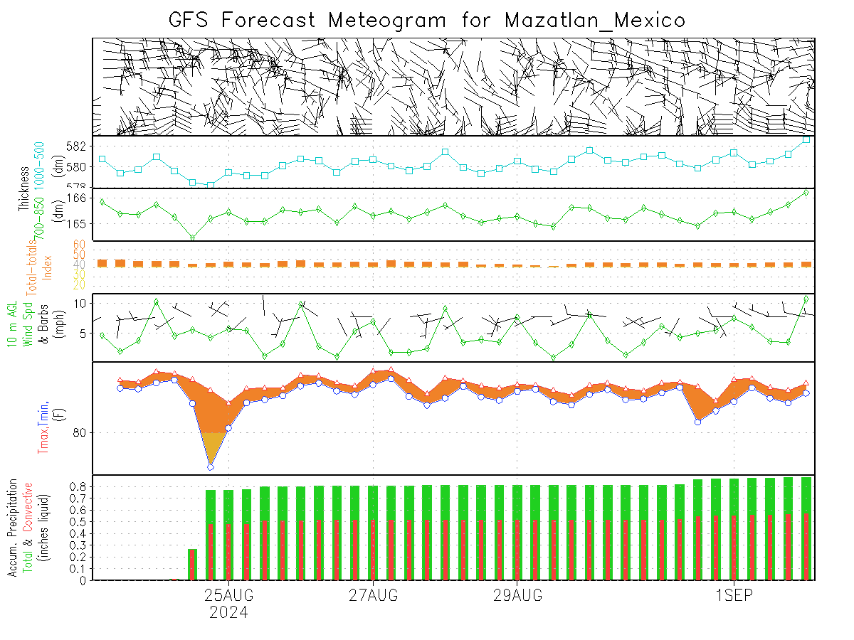
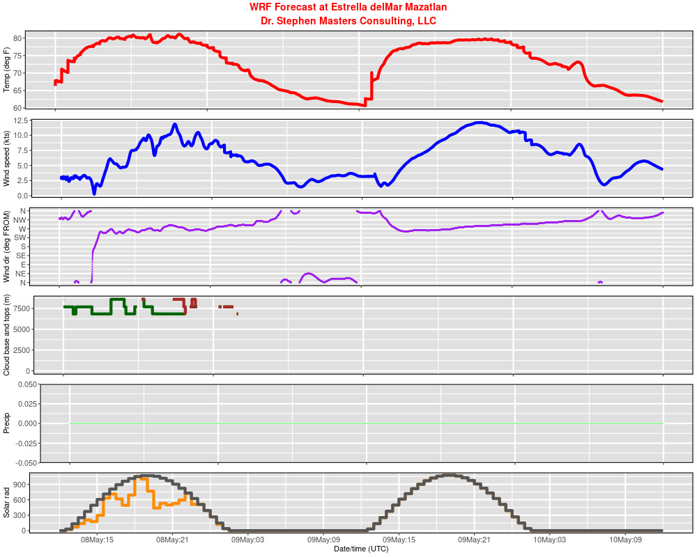
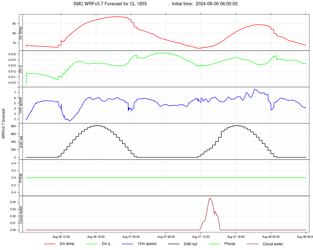
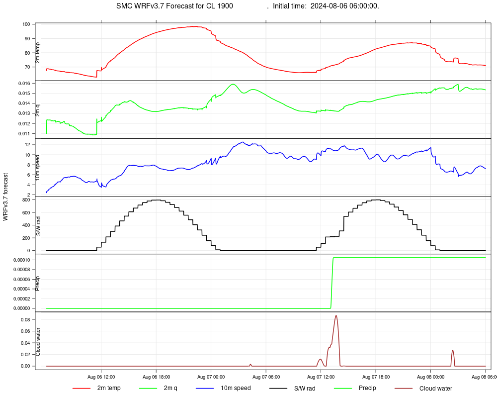
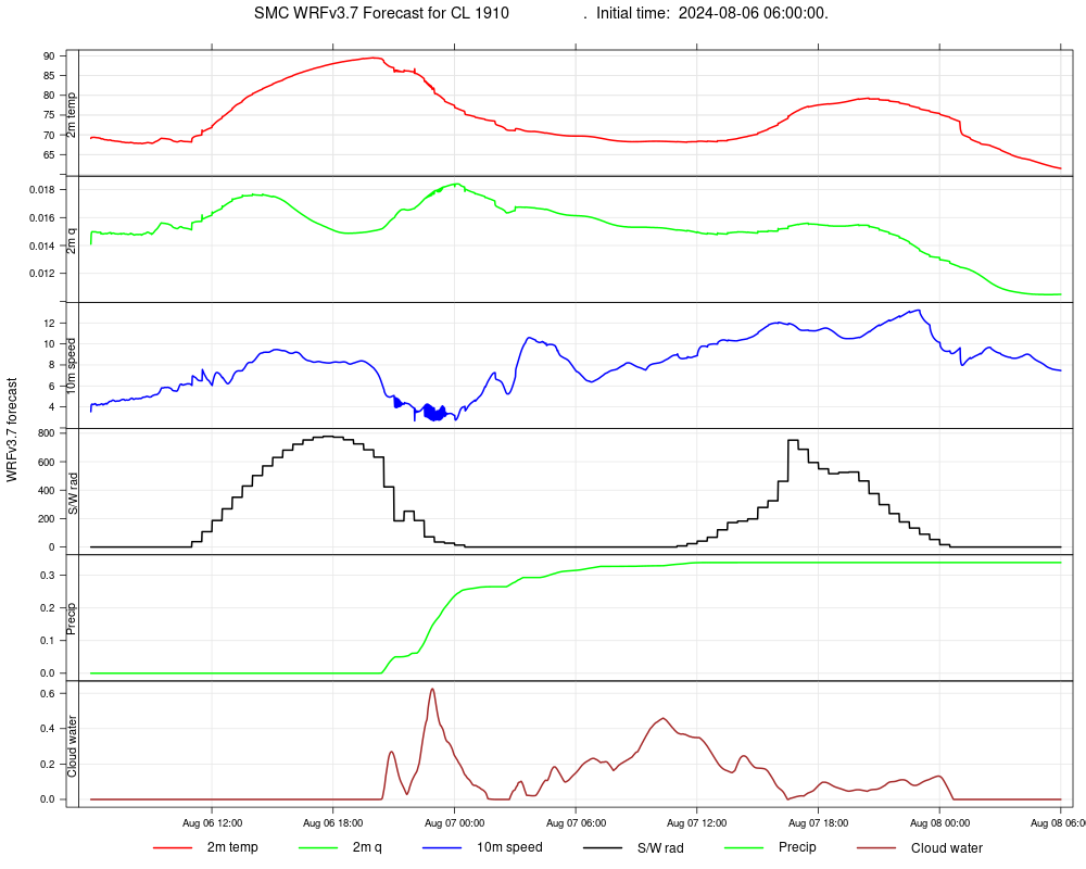
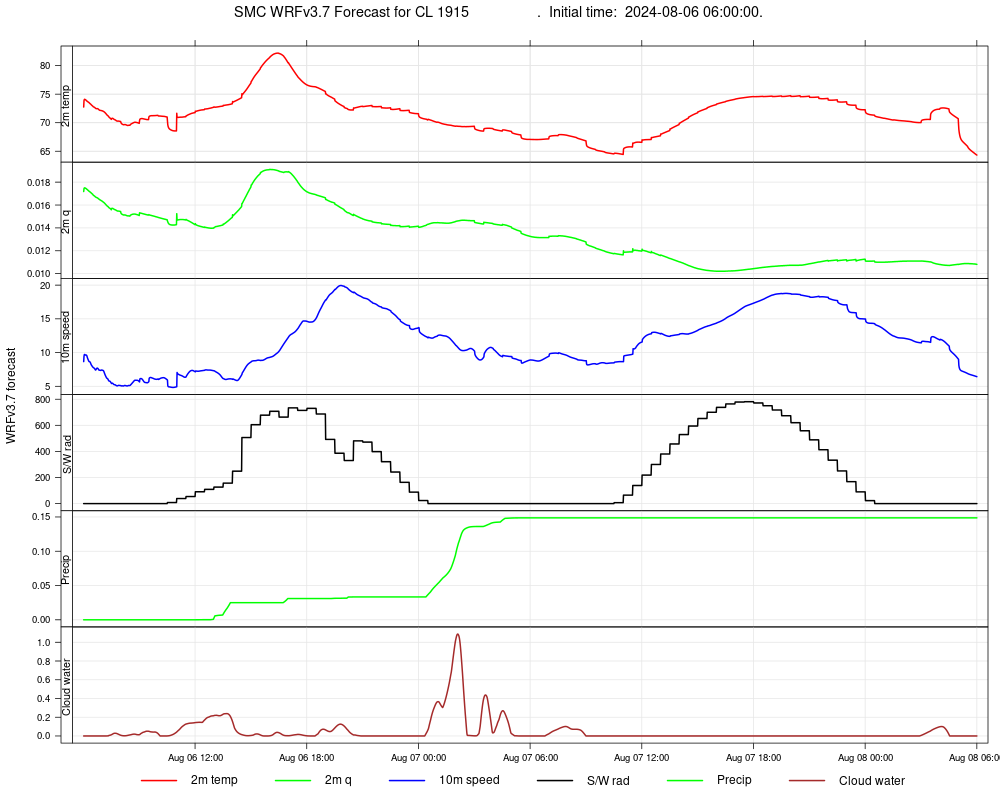
"True Color" image created by combining three different channels from the GOES weather satellite. This image may look similar to what your eyes might see if they were looking down at these reigons. Of course, it will be dark at night! 
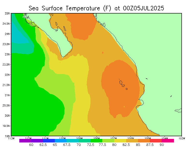
GOES channel 13 infrared channel. This image will be like looking at a temperature map--high clouds will be bright white and lower clouds and warmer ground will be dark. Near coastal areas, you will be able to see the temperature differences betweeen land and water.
Mexico Click for full view Click for full view
Texas, Oklahoma, Arkansas Click for full view Click for full view
Upper Midwest Click for full view Click for full view
New England Click for full view Click for full view

Other forecasts

GFS and WRF forecasts for Mexico
Click on images for full-size view
10-day GFS forecast48-hour WRF forecast
Click for full view Click for full view

Forecast weather maps
Outer WRF domain: Mexico
SLP and Hourly Precipitation
2m AGL Temperature
10m AGL Winds
Inner WRF domain: Mazatlan
SLP and Hourly Precipitation
2m AGL Temperature
10m AGL Winds


Eastern United States
SLP and Hourly Precipitation
2m AGL Temperature
10m AGL Winds

Forecast meteograms
LocationHourlySub-hourly
Estrella delMar Mazatlan
Center Line 1755 UTC
Center Line 1800 UTC
Center Line 1805 UTC
Center Line 1810 UTC
Center Line 1815 UTC
Center Line 1820 UTC
Center Line 1825 UTC
Center Line 1830 UTC
Center Line 1835 UTC
Center Line 1840 UTC
Center Line 1845 UTC
Center Line 1850 UTC
Center Line 1855 UTC
Center Line 1900 UTC
Center Line 1905 UTC
Center Line 1910 UTC
Center Line 1915 UTC

Other links